 Projects Menu
Projects > Water Balance > CA Crop and Soil ET
California Crop and Soil Evapotranspiration
| Date: | 2003 |
| Location: | California |
| Sponsors: | CALFED, DWR, and USBR |
| Reports Available: | ITRC Report No. 03-001 |
| Online Data: | Online Evapotranspiration Data |
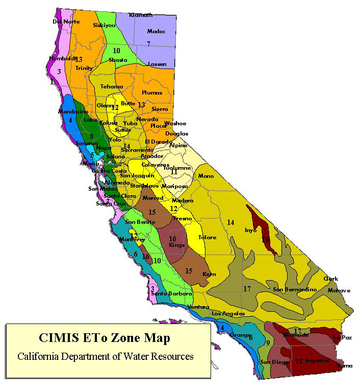
ETo Zone Map of California
The purpose of this study was to create a publication presenting evapotranspiration for crops and soils in 13 California Dept. of Water Resources (DWR) Reference Evaporation Zones (ETo Zones) for three types of precipitation years:
- typical
- wet
- dry
For persons interested in irrigation scheduling and design, the publication includes instructions on how to adjust ET values for:
- different irrigation systems
- different growing seasons
It also includes instructions, for persons doing regional or irrigation district water balances, on how to adjust values for:
- bare spots and decreased plant vigor
- multiple crops on the same field
One of the main purposes of this
project was to provide California water users with
crop/soil ET values that take into account regional
environmental and management differences.
Furthermore, with the ETo and crop/soil ET
information presented in each table, crop
coefficients can be calculated with relative ease
for regions throughout the state.
The resultant publication, ITRC Report No. 03-001, contains the most comprehensive
crop/soil ET values available to date for
California. The data can also be accessed on
the ITRC website's Online Evapotranspiration Data section.